B29 Crash Site - Stob Na Boine Druim-fhinn
Thursday 23rd April 2026
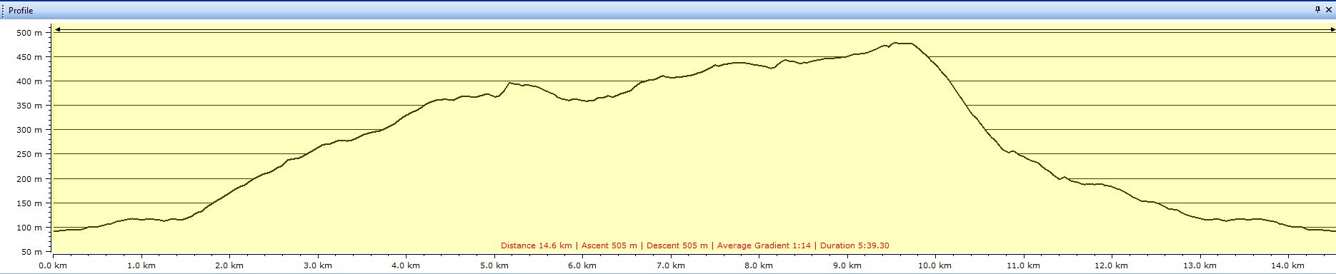
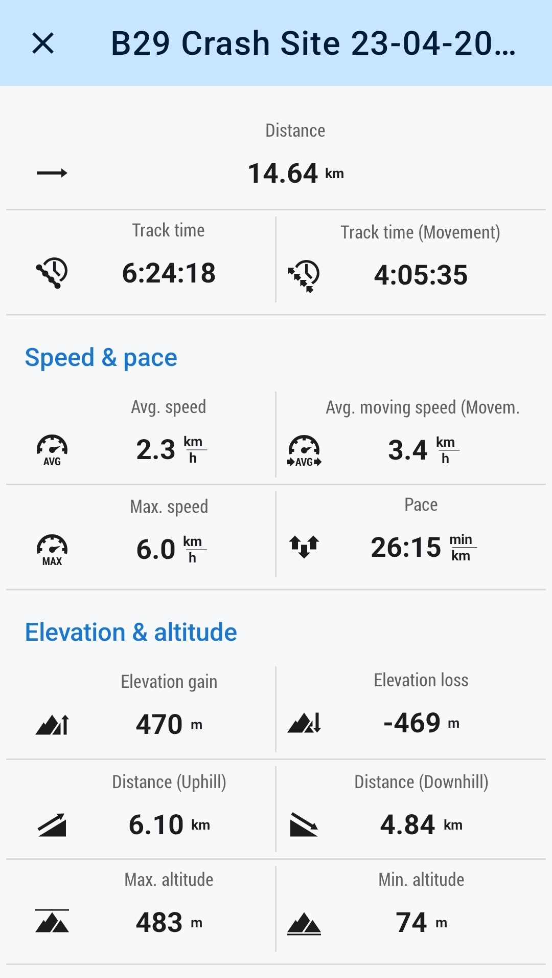
15kms
6hrs 20mins
If you want the short version of this walk, well here it is; “14 kilometres of easy, steady walking, 1 kilometre of ducking and clawing our way through a very swampy area of forest”.
And the long version; well read on.
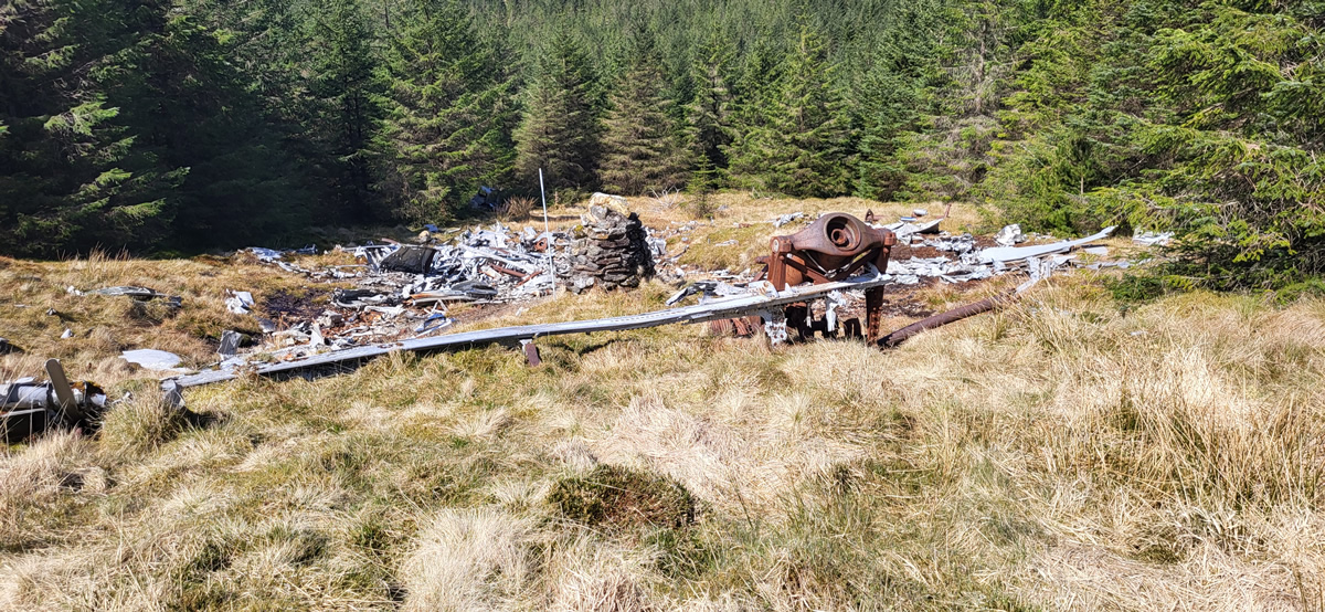
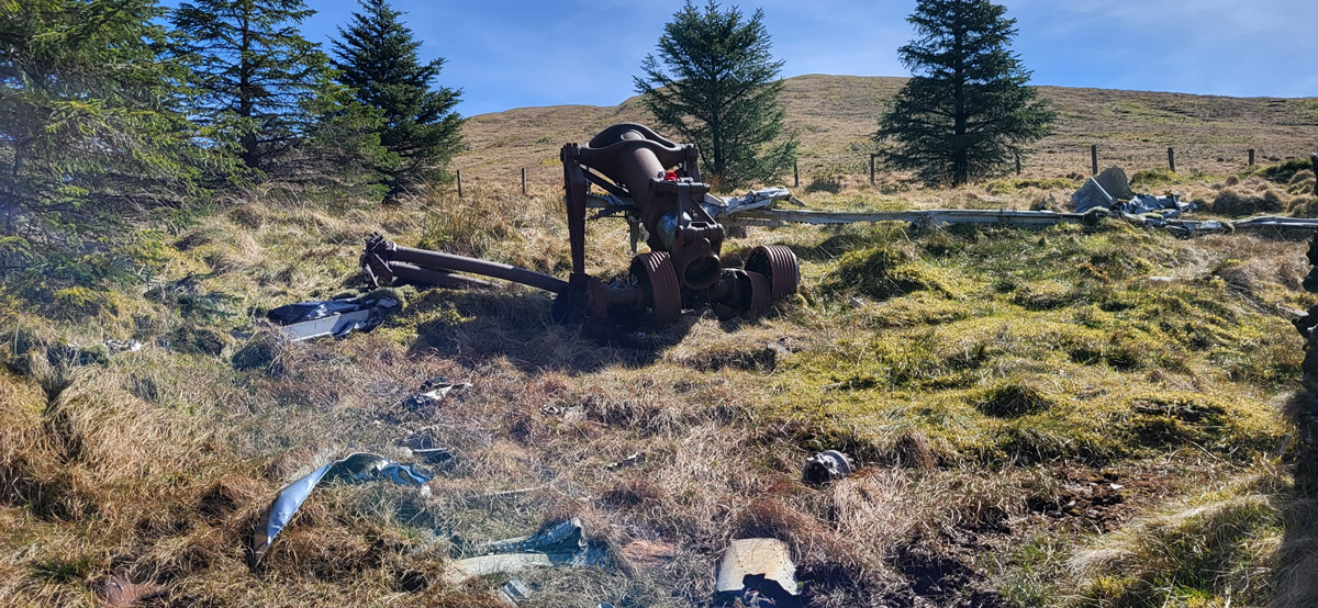
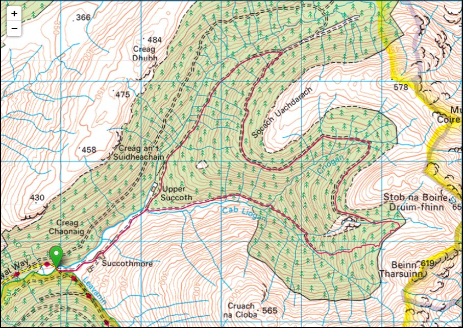
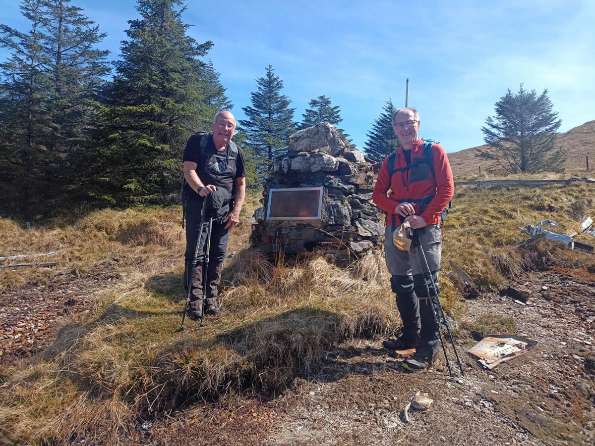
We are no strangers to the crash site where a USAF B29 aircraft crashed in January 1949 to the west of and just below the summit of Stob Na Boine Druim-fhinn as Mike usually incorporates it into walks in the hills above Lochgoilhead. However, this involves an approach from the east and the traverse of high summits and rough open hillsides, therefore when an episode of Paul Murton’s series of walks, lochs and rivers aired on BBC in which he relates a story when as a young lad and living in Ardentinny, he and a friend were exploring the local hills they came across the crash site, and now, in this episode he wished to revisit it and was doing so from the west just beyond Strachur; this sowed the seed in Mike’s mind for an alternative approach, the only problem being, Paul Murton’s short clip was a few steps through a forest and he was there at the crash site, so what route he took was a matter of conjecture. On previous walks in the area Mike, Ian and myself had scoped out the most probable, and possible routes, and late last year Mike set off solo and did in fact find a route to the crash site, a route that he retraced for his return. But that was too easy! Why not find a circular route, much better than a simple linear walk.
Still with me? Okay, we had a plan, lets put it into action.
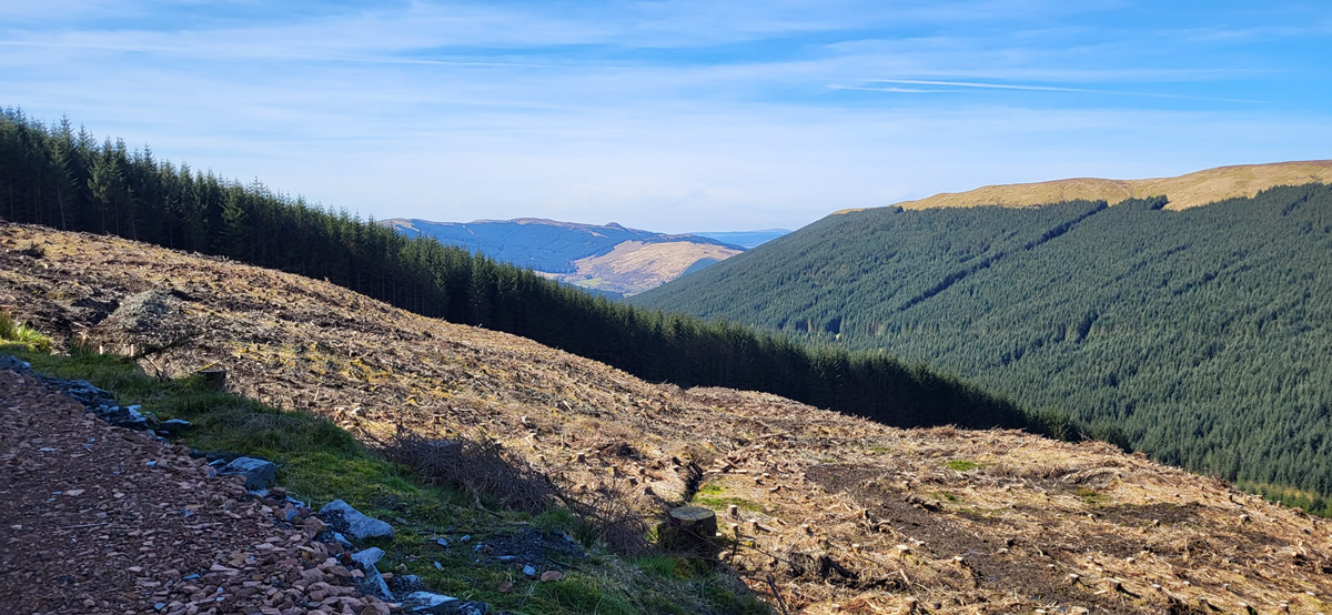
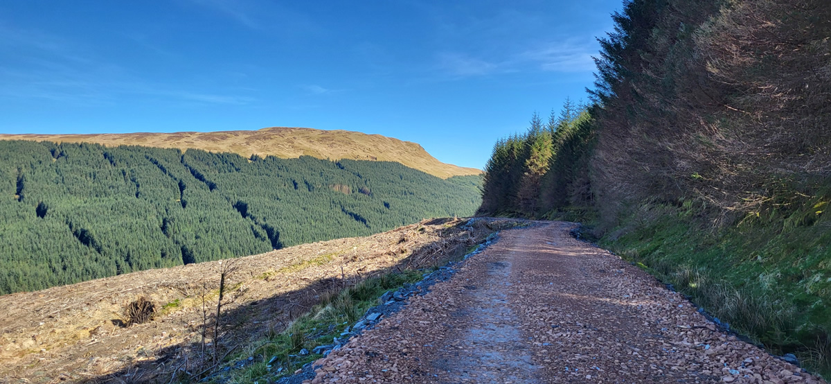
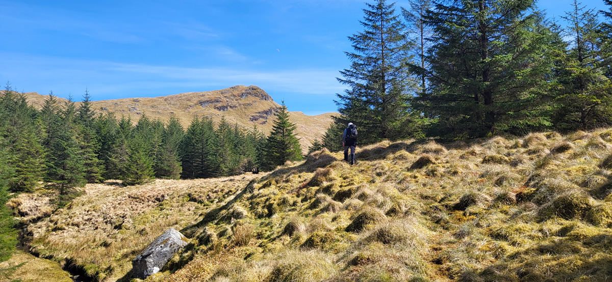
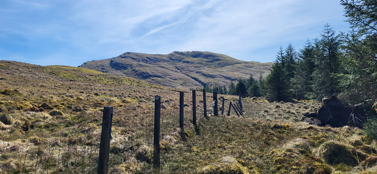
We parked up at the end of the minor road leading to Succothmore and walked up past the farm and followed the good track as it crossed the bridge over the burn below the ruins of Upper Succoth and made the long, steady ascent high above the River Cur to the rather oddly named spot detailed on the map as The Roundel which I can only assume relates to the remains of what may well have been a very small shepherds shelter or even just a walled enclosure where today there is a junction of forest tracks, and where we were into new ground for us as we swung sharp right onto the track which we hoped would take us to within striking distance of the main crash site. It had been uphill all the way since the start, but the gradient was never too steep, and the forest is open and in sections felled, so we had ever increasing views as we gained height and in the sunshine and clear blue skies there was no hurry to our day, a day to enjoy the moment.
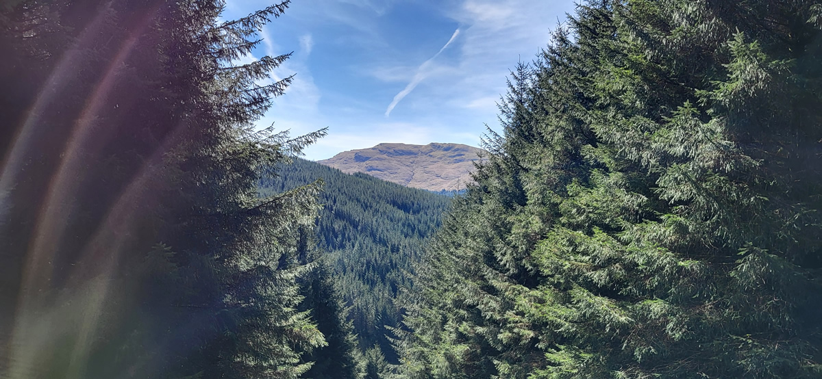
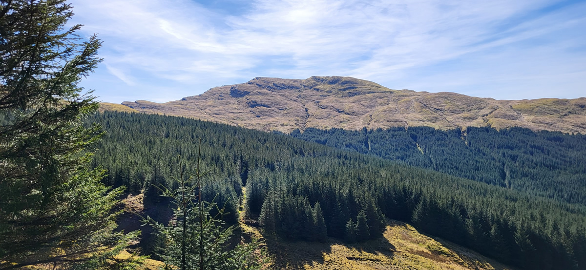
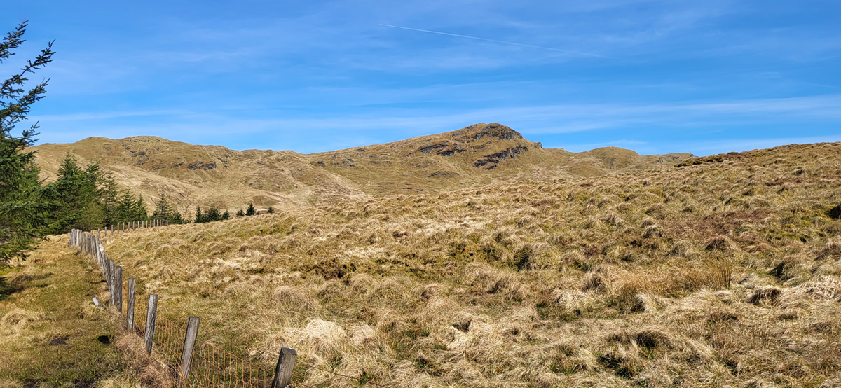
Ahead of us lay almost 5 kilometres of what we hoped would be similarly good forest track as it made long, sweeping curves around the shoulders of Socach Uachdarach and Bran Socach to it’s end point above two prominent gullies, between which we intended to move through the forest for the final leg to the crash site. And so it was, the standard turning circle that is usually found at the end of forest tracks was reached without difficulty, and it was time for lunch and a serious look at the maps and our options.
From our current point at the end of the track, it was no more that 500 metres direct bearing through the forest to the crash site. However, as we stood in the turning circle dense forest lay directly ahead and we could see that the ground underfoot was not just wet, but very swampy. From our current position we needed to hit a point between the two gullies, cross the stream flowing there and then either head for open hillside and handrail the forest boundary to the crash site, or take a bearing from the gully and go directly through the forest to the crash site. With these options in mind we set off to take each section as it came.
Within a few metres of the start we were already clearing our way through the branches, either pushing them away from our head and eyes, or ducking and wriggling our rucksacks free of low branches and all the while making sure that each step was on solid ground or at least broken branches as the swampy conditions were all around us. A hundred or so metres in we were relieved to find that we were standing above the south end of the higher gully, and rather surprised to see that the gully was grassy and not too steep, while on the other side the forest looked a little less dense. We dropped down, crossed the stream with ease and climbed about half way up the opposite side. At this point we re-appraised our position; above us, the forest was slightly less dense, but underfoot was an unknown factor; ahead of us we could see that the lower level of the gully was rough grass and looked quite solid underfoot. To stick with the gully would mean a slight swing away from the direct bearing to the crash site, but it would lead us to the forest boundary and that handrail to the crash site. The drier option it was, we would take the gully route.
We moved along the gully, always keeping a watchful eye on the forest above just to be sure we did not miss a gap that would allow us to break out above the gully. And a break we did find, albeit it was more likely an animal track, as we had seen numerous deer tracks earlier on the forest track, and had even seen a fox scurry ahead of us in the gully. A good sign as neither fox nor deer were going to be wandering around any swampy areas. And sure enough, as we took to the track and headed towards the forest boundary the ground improved with every step; and once alongside the boundary fence it was simply a matter of following it a few metres directly to the crash site. The outbound route established. Plan half complete.
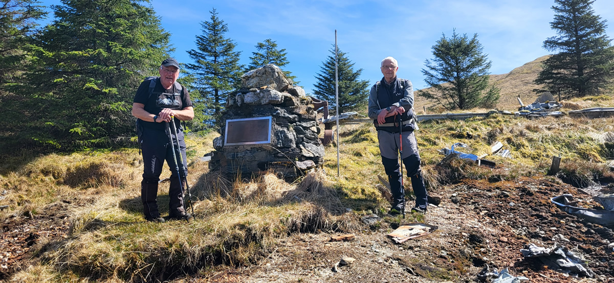
We spent a short time looking over the main crash site and the memorial before setting out to make our return via the linear route that Mike had taken a few month ago. I should state at this point that Mike had warned us that there was a kilometre of forest to pass through before we would reach the old, but distinguishable, forest track at the end of Cab Loigan, a kilometre of swampy ground, which Mike described as “pretty bad”.
“Pretty bad” was an understatement, it was a very difficult kilometre to negotiate, again the trees were old, often brittle branches down to ground level, an old forest, there were no nice straight lines of trees down which to walk, but rather a haphazard planting, and probable worst of all was the ground underfoot. No nice layers of pines or soft moss to walk on, instead the ground was a virtual swamp where in areas my trekking pole just went down and down as I tested the ground ahead. We transited the forest, each between 10 to 15 metres apart finding our own footfall and keeping in eye contact to ensure we all stayed on the correct bearing. An interesting stop – start motion as we called out to stay close or warn of a particular hazard, as did Mike, soon enough for Ian and I to stop, but not before he had gone down. I looked up to see him almost on his knees as he extracted a leg which had gone down to above knee level in the muckiest gloop he could find. It was an interesting 45 minutes or so, 45 minutes for barely 1 kilometre of progress.
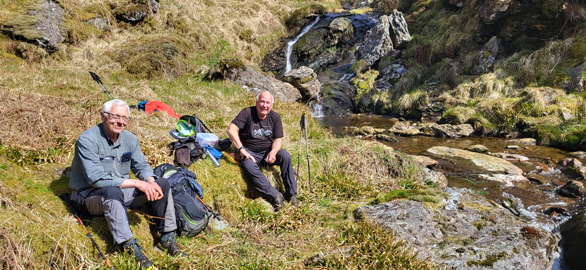
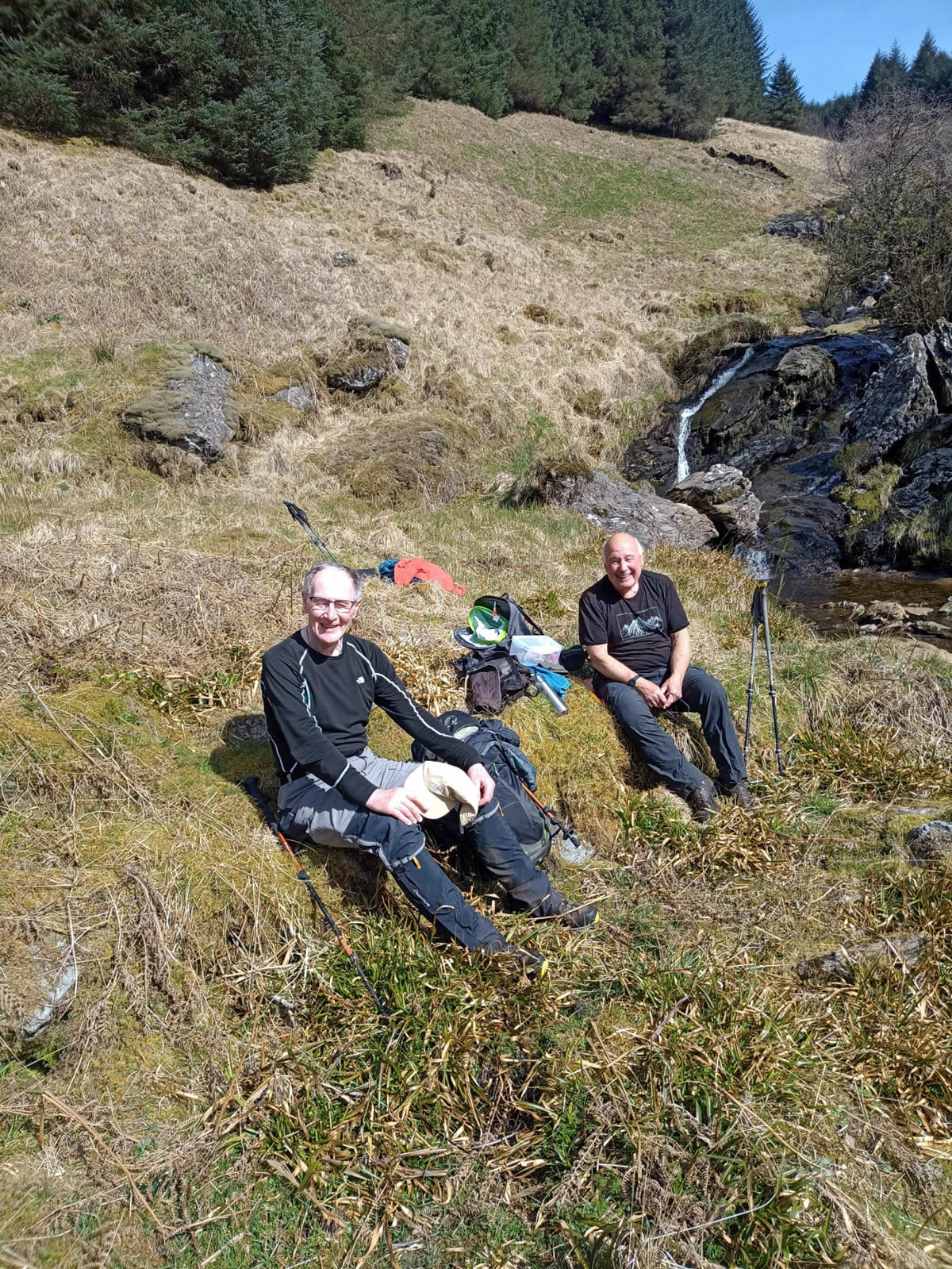
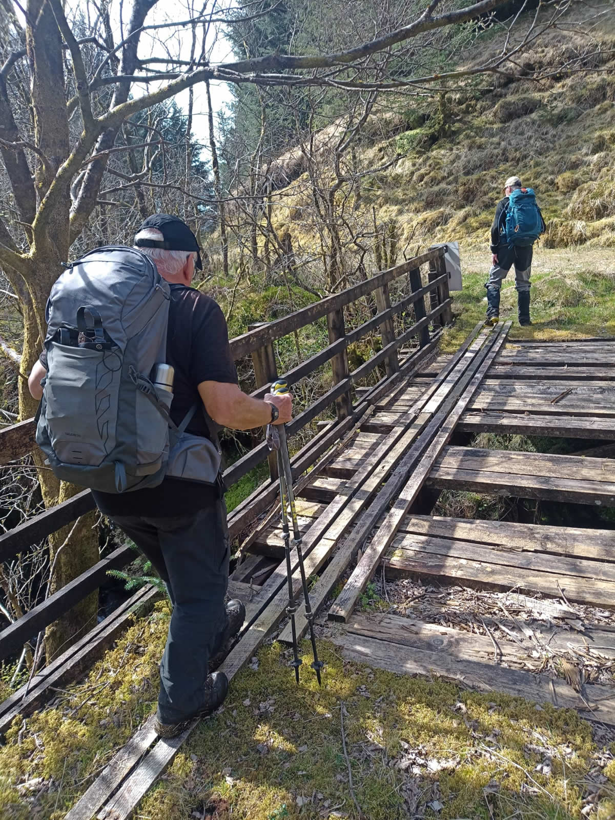
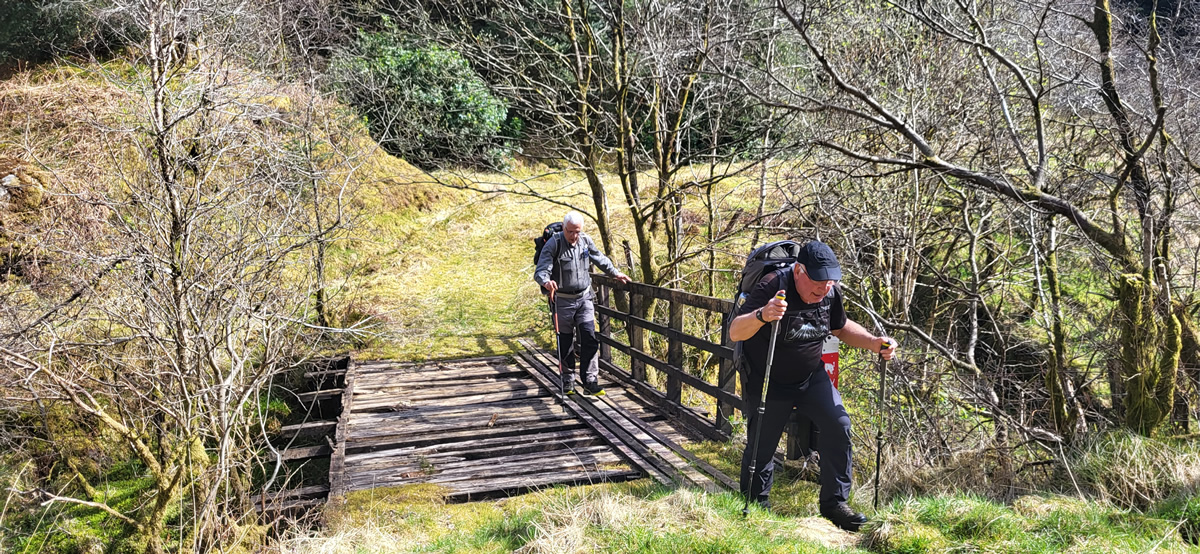
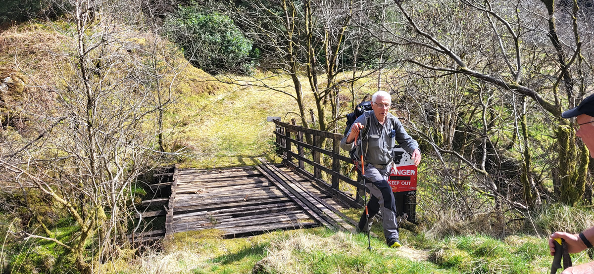
Again it was with some relief that we navigated successfully out of the forest to the head of a once broad but now somewhat overgrown but solid and distinguishable forest track that would take us back to the bridge at Upper Succoth. But not before we had a welcome afternoon break by a small waterfall and crossed a rather dodgy bridge. Beyond Upper Succoth it was just a mater of strolling through the lower pastures of Succothmore and the end of a very interesting and enjoyable day.
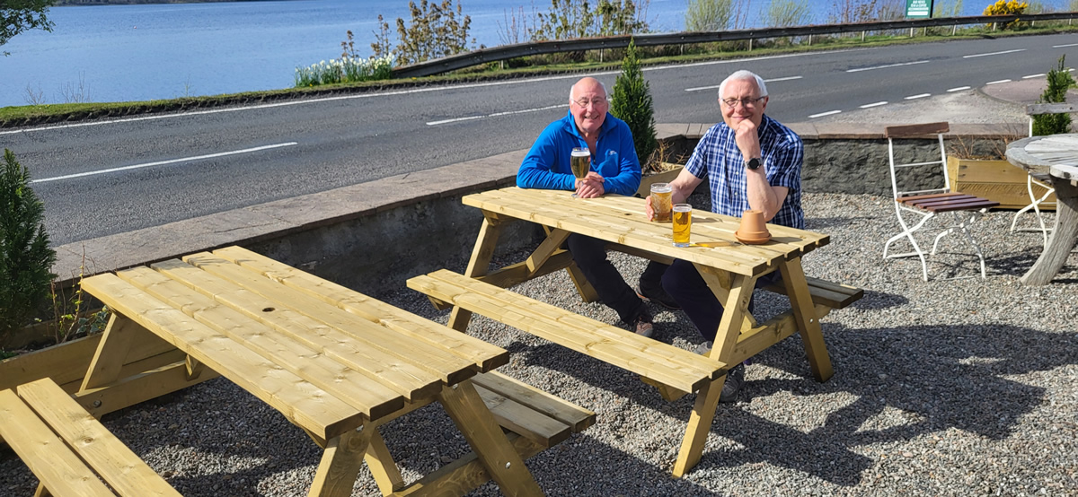
Isn’t it just great when a plan comes to fruition.
Thanks Mike and Ian, another great day in the hills.
Photo Gallery
Click the buttons to select photo size.