Sron a Chlachain(513m)
Saturday 4th May 2024
9kms
4hrs 45mins
A glance at the route profile on the right and you will see that there is no leisurely start to this walk, it is straight out of the car, a short stroll around the edge of the football field then straight uphill for a climb of 400 metres to the summit cairns on Sron a’ Chlachain. However, there is plenty enroute to distract from the effort involved in the climb; and almost immediately you come to Fingal’s Stone, a small standing stone which folklore says originally marked the burial site of Finn Macool, the mythical giant of The Giants Causeway and Fingal’s Cave renown, before it was moved to its’s current location nearer to the village.
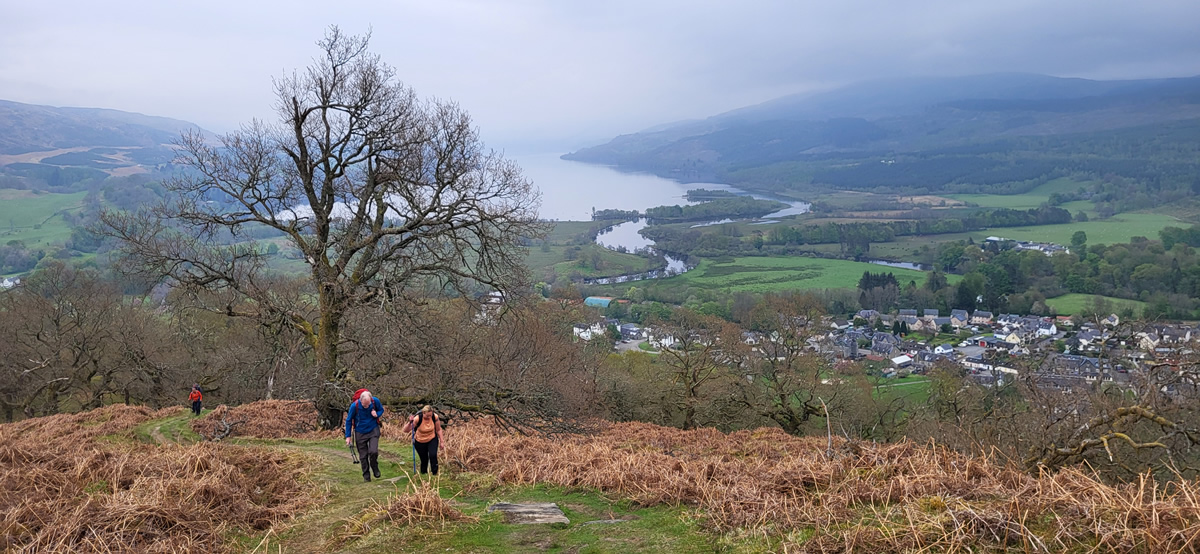
A few steps beyond Fingal’s Stone the path enters a fine area of old oak trees and winds steeply through them until it emerges on the open hillside, with views already opening up behind you of Killin and Loch Tay. Ahead, the path is clearly visible across the grassy hillside as it winds quite steeply uphill towards the craggy rocks on the ridgeline of Sron a’ Chlachain and yet another fine viewpoint from which to gaze over the hillside to Killin and Loch Tay. From the crags of Sron a’ Chlachain it is then a short, final pull up alongside an old stone wall to the large cairn marking the high point of today's walk, the 510 metre top of Creag Bhuidhe and time to sit and relax in fine weather and forget the effort of the ascent.
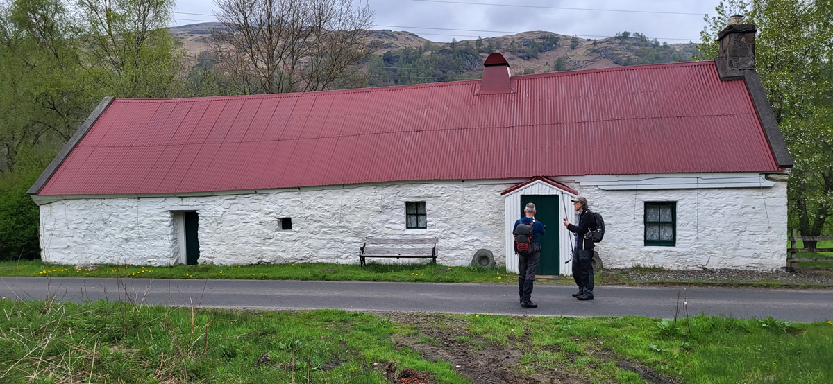
Look once again at the profile of today’s walk, and you will see the symmetry of both ascent and decent of Creag Bhuide. Symmetrical in profile but certainly not in the ground underfoot; whereas the ascent followed a defined path, the descent was over pathless and rough hillside which required a little more concentration of foot placement. However, it did make for a fairly quick descent, and we were soon on the old track in the lower reaches of Glen Lochy and heading towards the Moirlanich Longhouse, a 19th century byre dwelling, now preserved as an example of a traditional rural home of the time.
A short stretch of road walking and we were soon surveying the remain of Finlarig Castle and listening to David’s chat on the history of the buildings. I found the following link rather an interesting read should you be interested in further details - Finlarig Castle
One thing about walking in the countryside is that you should not be surprised by what surprises you find, and today it was a gem; a couple of trees obviously felled by beavers which have been re-introduced to the Loch Tay area over the last few years. I found the pattern on the tree trunk made by the beavers teeth while gnawing at the wood to be quite amazing, and so clearly visible. Wonderful.
We completed our walk along the shores of Loch Tay and into Killin where refreshments were at hand in the Killin Hotel, the perfect end to a great day. Thanks David and to all, I hope you found the day as pleasant as I did. John
Photo Gallery
Click the buttons to select photo size.