Dun Caan - Isle of Raasay(444m)
Monday 14th July 2014
17kms
6hrs 30mins
We had just spent 4 days in Torridon and 6 on Skye and in all our walks only had a few short spells of rain, mainly in Torridon, but nothing that wet us for long. Saturday last, which was a non-walking day for us when we did the touristy bit of driving around and touching base with all the tourist spots was the first real rain we had had during our time on Skye.
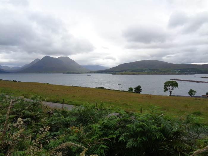
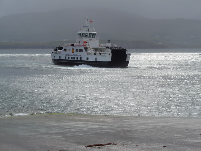
I suppose it was just too much to expect to get away without one days walking when we did get a soaking, and today, Monday, our last day on Skye was that day. To be fair to Skye, we were actually soaked while walking on Raasay. We had been up extra early to get from Glen Brittle to Sconser in time to catch the 8:25 ferry to Raasay. Our objective for the day was Dun Caan, the prominent top on Raasay which stands out in almost every view of the island as you drive around the eastern coastal roads of Skye.
But first of all we headed along the coast road from the new harbour in Churchton Bay to the site of the old harbour at Suisnish Point, originally built to serve the early 20th century iron ore mine in the hillside above the point. Much evidence still remains of the mine buildings, especially the base structures of the five calcining kilns. Information on the mine contained in Historic Scotland's website has the interesting fact that: During World War 1, the mine came under the control of the Ministry of Munitions and German prisoners-of-war held locally were employed in production - a controversial move which contravened the terms of the Hague Convention. The records relating to this were destroyed deliberately in 1920.
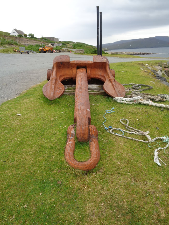
Alongside of the harbour, there also lies a huge anchor. On inspecting this it raised a few questions as there is what would appear to be a Swastika on the left palm, however, as the Swastika as a German symbol is post WW1 it obviously did not relate to the German prisoners working at the mine. The problem was solved by some Google sleuthing, and it goes something like this: The anchor was made in Sunderland and was laid just off the pier around 1900 to keep the iron ore boats off the pier whilst loading. As the hopper on the pier did not move the boats were moved under it using the anchors. The "swastika", or in geometric terms an irregular icosagon or 20-sided polygon, has been around as a symbol for thousands of years, particularly as a Hindu symbol in the holy texts, to mean luck, Brahma or samsara (rebirth). W L Byers of Sunderland, the manufactures of the anchor often used the swastika as a symbol on their anchors, the Royal Museum at Greenwich actually sells a print of one of Byers anchors with the said swastika shown on the palms of the anchor.
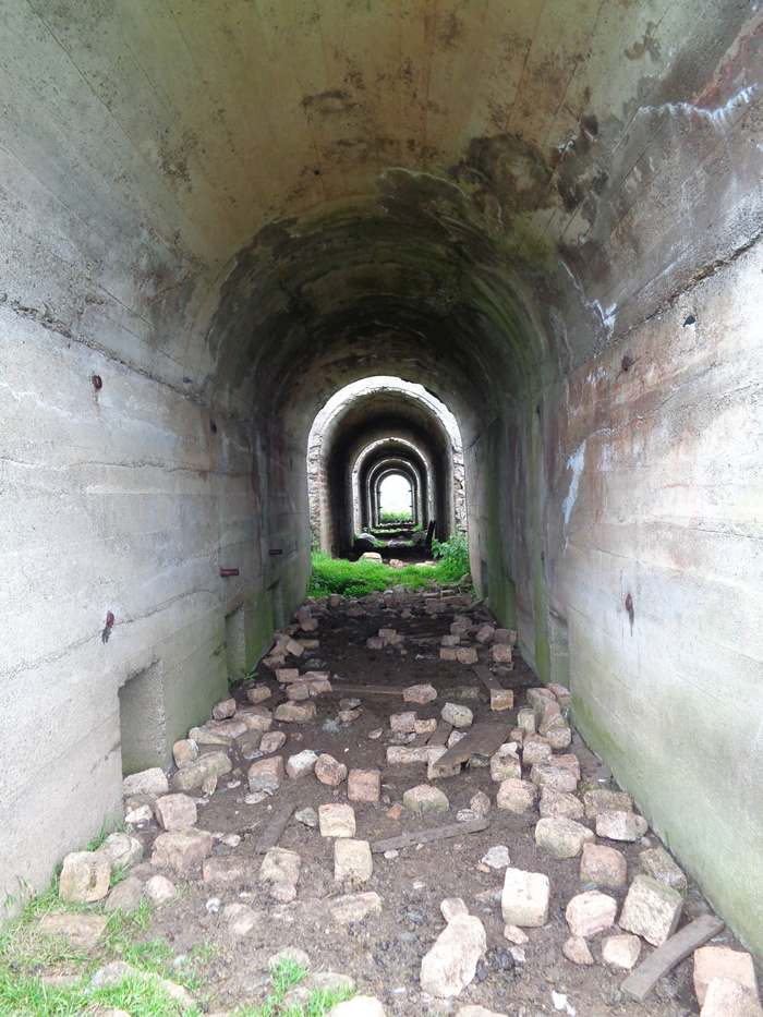
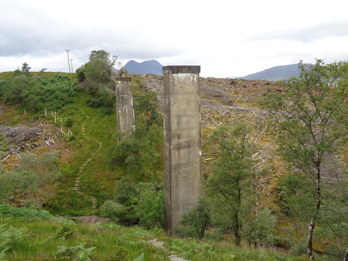
From the harbour we headed for the signposted track, once the narrow gauge railway linking the harbour with the mine, 2½ kilometres away in the hills above the harbour, passing below the concrete pillars that carried the railway on a viaduct over a small gully and burn. We hadn't done a great deal of hill walking to this point, having been caught up in the history and interesting surroundings of the old mine and harbour.
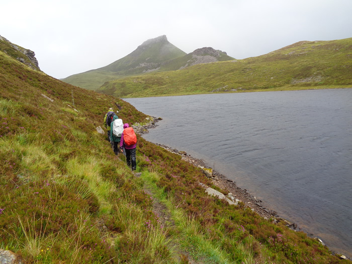
Once beyond the old mine we followed the good forest track for about 500 metres before taking to a much narrower track, rocky and wet in places which followed the course of the Inverarish Burn between heather clad mounds and rocky outcrops back to its source at Loch na Mna, situated just below the steep southern shoulder of Dun Caan.
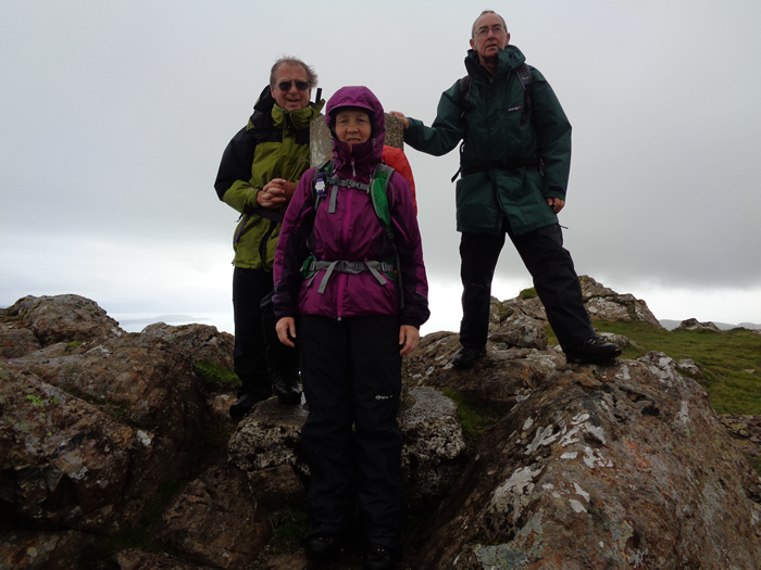
From here, a short, but steep ascent was made to the narrow summit of Dun Caan, where the wind and rain that had been growing steadily worse as the day progressed did its utmost to deny us a sheltered spot for some lunch. We re-traced our steps back to the forest track, and took a more direct route through the forest and back to Raasay House, where a very helpful staff showed us where we could leave our wet packs and waterproofs while we indulged in a nice coffee and some delicious home made cakes as we awaited the ferry back to Sconser.
Today was a very pleasant end to a great 10 days spent between Torridon and Skye. My thanks to Brian for the invite to Skye, and to everyone who made the walks so enjoyable.
PS Acknowledgements are made to the following websites as the source of information on the Raasay Ore Mine and the old anchor mentioned in the text above:
Life at the End of the Road (Thanks Lindsay - Some good info here)
Dun Caan - Isle of Raasay - Photo Gallery
Click any photo to activate large screen photo gallery